
Public Workshop 1 - Highlights
Thank you to all that made it to our first workshop. It was wonderful event, and we received tons of comments.
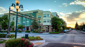
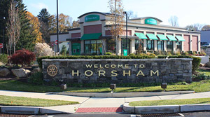
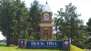
At the workshop, participants were asked to place dots on images of streetscapes that appealed to them most from the first poster below. These photos are the top three chosen.
| Tied for First Choice | Tied for First Choice | Third Choice |
 |
 |
 |
Below are a list of posters that were on display at the workshop. Click on the thumbnail to see the PDF.
| 1.3MB (PDF) | ||
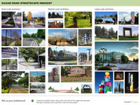 |
Workshop participants selected 3 images from this display that appealed to them as an example of the type of character they would like to see around the intersection. | |
| 2MB (PDF) | ||
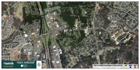 |
Workshop participants used colored stickers to identify key origins (where they live) and key destinations (where they work and shop, etc.). The purpose of this assignment is to better understand how people use the intersection, so that the Town and consultant team can develop improvements that help move people through the area more effeciently. | |
| 2MB (PDF) | ||
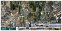 |
This map was used to show participants the area being studied for this project. When taking on a project such as this, planners and designers need to identify areas that could be improved and areas that could be impacted. The team will conduct an analysis of various alternatives or options to improve the intersection; and ultimately, a preferred alternative will be chosen and refined based on input during the planning process. |
|
| 2MB (PDF) | ||
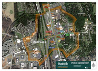 |
This map was used to show participants some of the key conflicts or constraints in the area. These constraints are considered during the alternatives analysis and used by team members in developing the proposed improvements. Designers attempt to avoid and minimize impacts to the greatest extent possible. |
In case you missed it, here is the video that was shown in the town hall lobby to guide you through the process: